
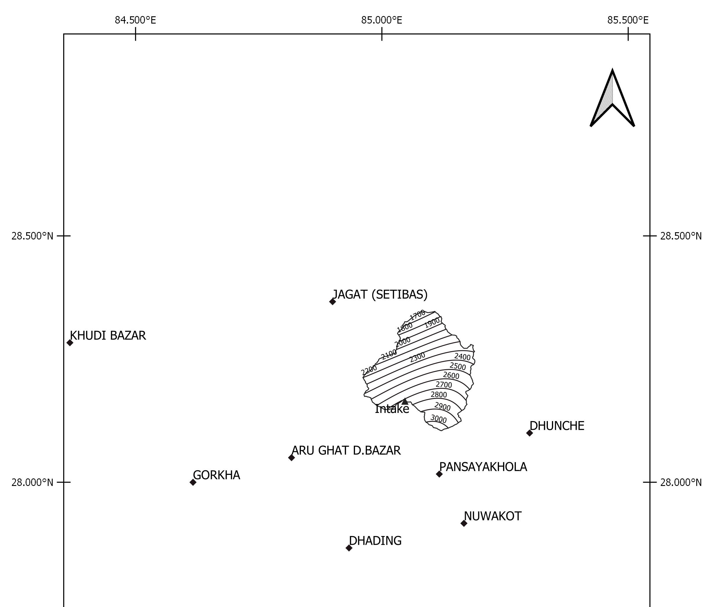
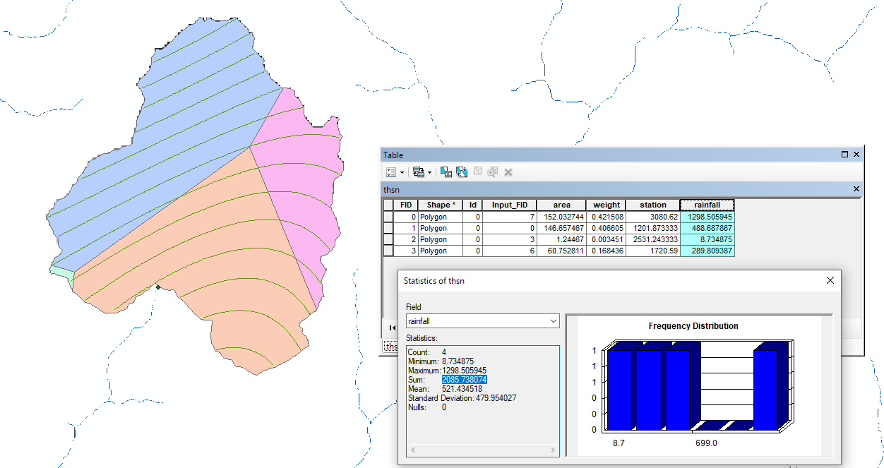
Geospatial analysis involves examining and interpreting spatial data to identify patterns, relationships, and trends. By leveraging geographic information and spatial data visualisation, it provides valuable insights for decision-making across various fields, including urban planning, environmental management, and infrastructure development.
Presentation is a vital aspect of professionalism. Clearly conveying information ensures that viewers and readers can easily understand the content and grasp the intended message.
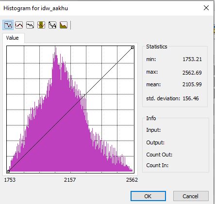
Presenting large datasets can be challenging. To enhance clarity and understanding, graphical representations are consistently used, as they are considered the most effective method for conveying complex information.
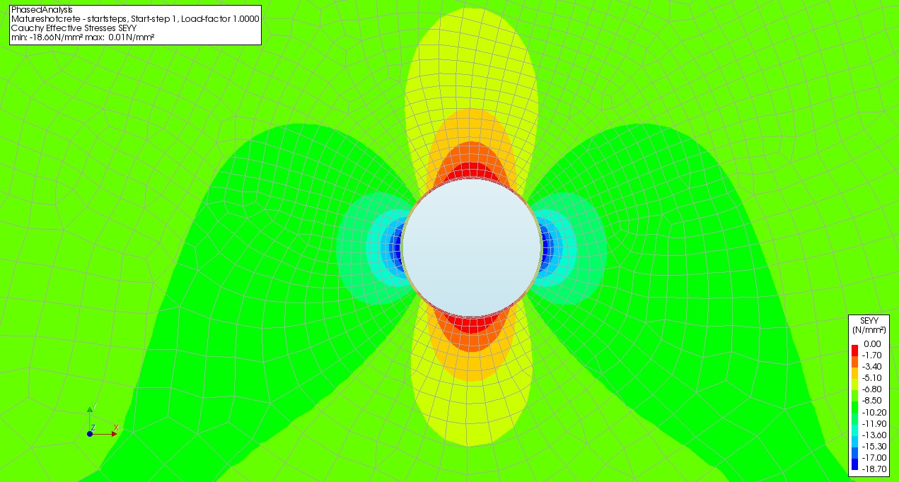
Performing structural analysis and design is essential as it provides insights into the stability and soundness of a structure. While this is a complex task, experience and expertise enable the development of optimal and cost-effective solutions to address structural challenges.
A Development Engineer with expertise in stormwater management, infrastructure approvals, and regulatory compliance. Skilled in hydraulic and hydrological modelling (HEC-RAS, DRAINS, and others), GIS-based site assessments, flood mapping, and designing drainage systems and roadways for diverse projects. Brings 10 years of experience in the hydropower sector, specialising in hydropower development, structural design, and construction supervision.